
Hiking the Paparoa Track: 4 days of ridgelines, rainforest and remarkable West Coast views
Spanning rainforest valleys, historic mining landscapes and dramatic ridge tops, the Paparoa Track is a 3 or 4-day Great Walk that reveals the wild beauty of New Zealand’s West Coast.
Paparoa Track: A 4-Day Great Walk Guide
The Paparoa Track is also one of New Zealand’s newest Great Walks, officially opened in 2019. More than just a hiking experience, the 55km track was created as a memorial for the families and local community affected by the Pike River mining disaster in 2010, which tragically claimed 29 lives.
It’s also New Zealand’s first dual-use Great Walk, meaning both hikers and mountain bikers can share the track. For walkers, this results in a more gradual gradient than some other Great Walks, but don’t let that fool you! The track is still very rocky in places, and you do need to pay attention to your footing, particularly on the first two days. If you are planning on biking, note that there are currently no e-bikes allowed on the track. We only saw about 12 cyclists across the whole 4 days and only 3-4 actually stayed in a hut with us, so it’s fair to say the Paparoa Tack still feels like much more of a hiking than biking track.
So where is the Paparoa Track?
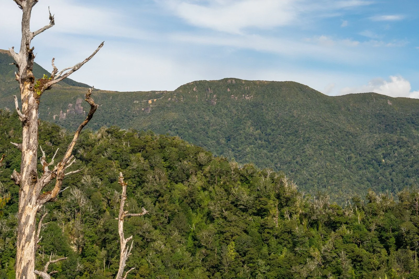
The Paparoa Track traverses the ranges of Paparoa National Park, and is usually started at Smoke-Ho near Blackball (30 minutes inland from Greymouth), ending on the coast at Punakaiki (about 40 minutes north of Greymouth), a journey of 55km and 1900m total elevation gain across the hike.
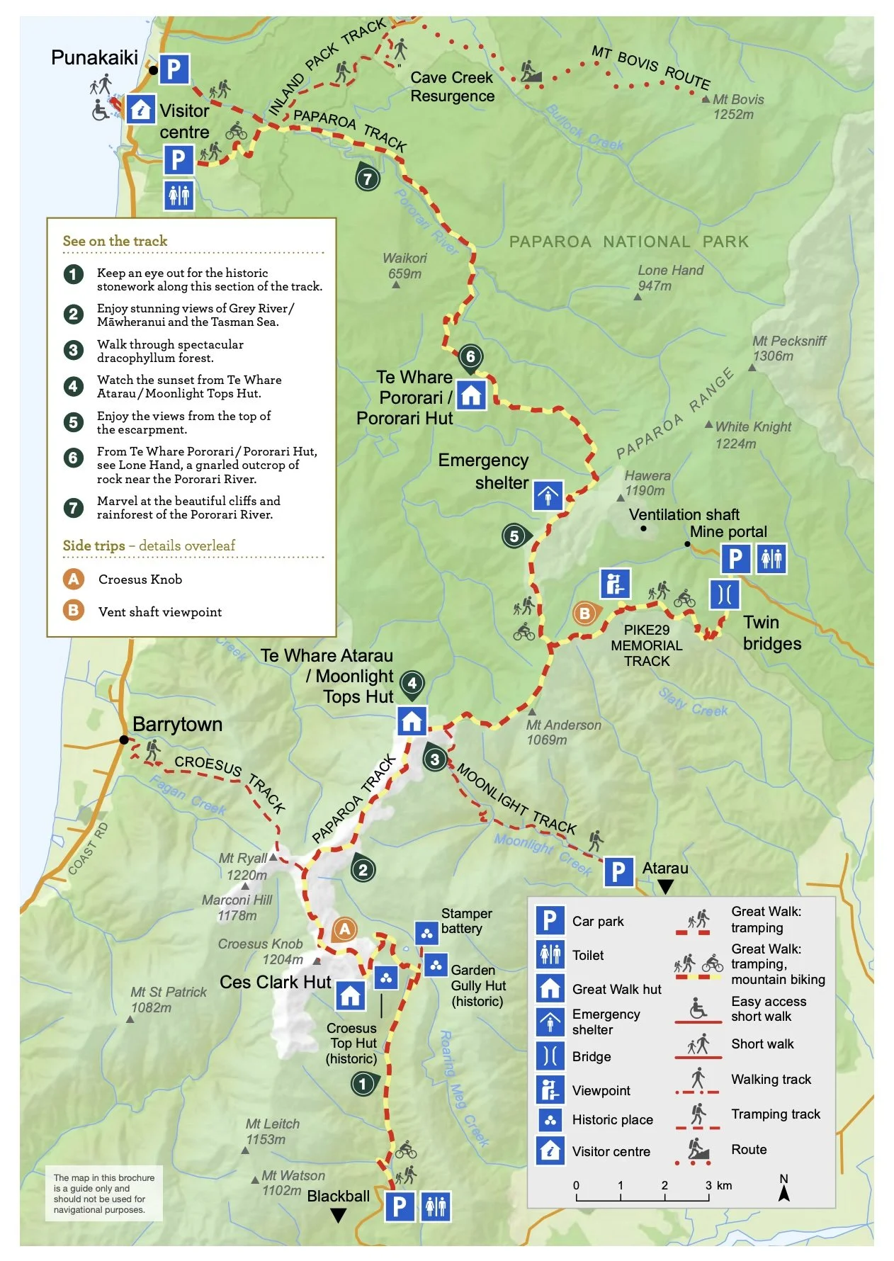
Walking the track in this direction means you get the biggest climb out of the way on the first day. The one-way nature of the track dictates that you’ll need to either get transport to the start of the track, or get your vehicle relocated to the end, which is what we did using Paparoa Track Transport - at $255 it wasn’t cheap, and we were paying a daily rental for our vehicle to be sitting there over that time, but it did gives us more flexibility in timings for our group of six, and was still cheaper than paying for transport at both ends of the track for a larger group.
What makes the Paparoa Track special?
Having now completed six multi-day hikes over the past eight years, I feel confident saying the Paparoa Track stands out from the rest in a few key areas. So what are the biggest highlights?
The elevated track and the incredible hut views - all three huts are positioned with elevated, expansive views, and for much of the track, especially the 2 days where you head across the tops, you’re rewarded with incredible visibility in all directions as you hike.
A more intimate experience - the fact that the huts only take 16-20 people also makes for a far more intimate experience than say the Fiordland Great Walks like Milford, Routeburn and Kepler Tracks where you are often sharing a hut with 40-50 other people. It also means you meet far less people out on the trail, adding to the sense that you are really away from it all!
A fascinating history - the track also weaves through areas rich in both gold and coal mining history not to mention the interesting history of the track build itself (make sure you check out the information boards at Pororari Hut for more on this).
Here’s what you can expect day by day:
Day 1: Smoke-ho car park to Ces Clark Hut
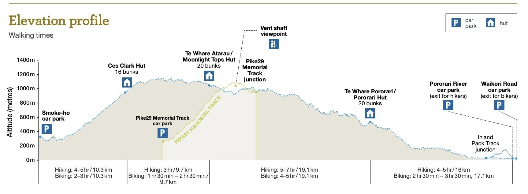
Distance: 10.3km, 762m elevation
Time: 4–5 hours (actual time 3:20)
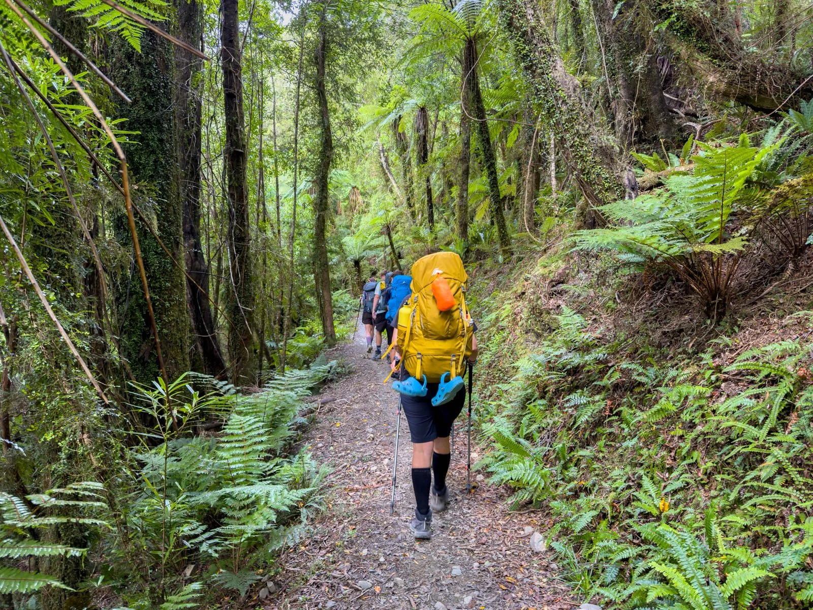
When starting the hike, the climb up to Ces Clark Hut can feel a little daunting, but in reality it’s a very manageable climb compared to some other Great Walk ascents we’ve done. The ascent is very gradual and not overly long, making for a comfortable introduction to the track.
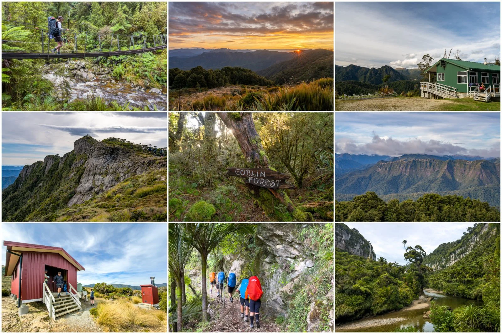
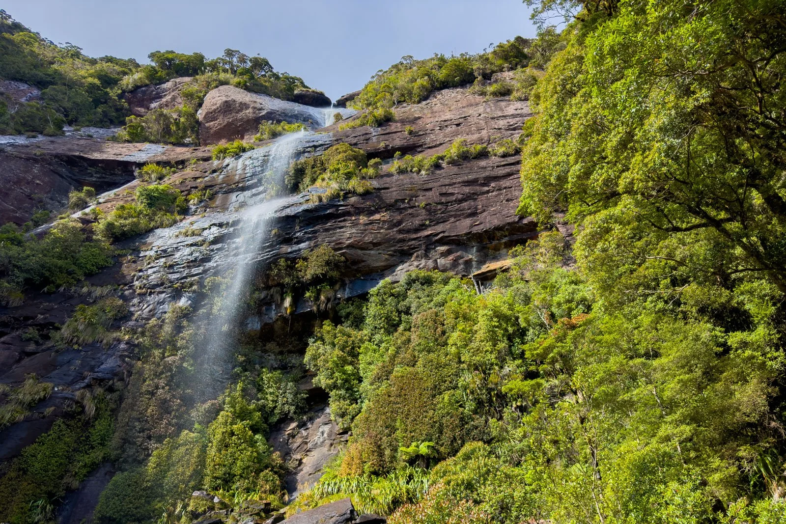
The trail begins alongside Blackball Creek before crossing back and forth via a series of one-person swing bridges. This section feels lush and distinctly rainforest-like, especially as we’d had decent rainfall the night before, which meant the rivers and side waterfalls were all pumping!
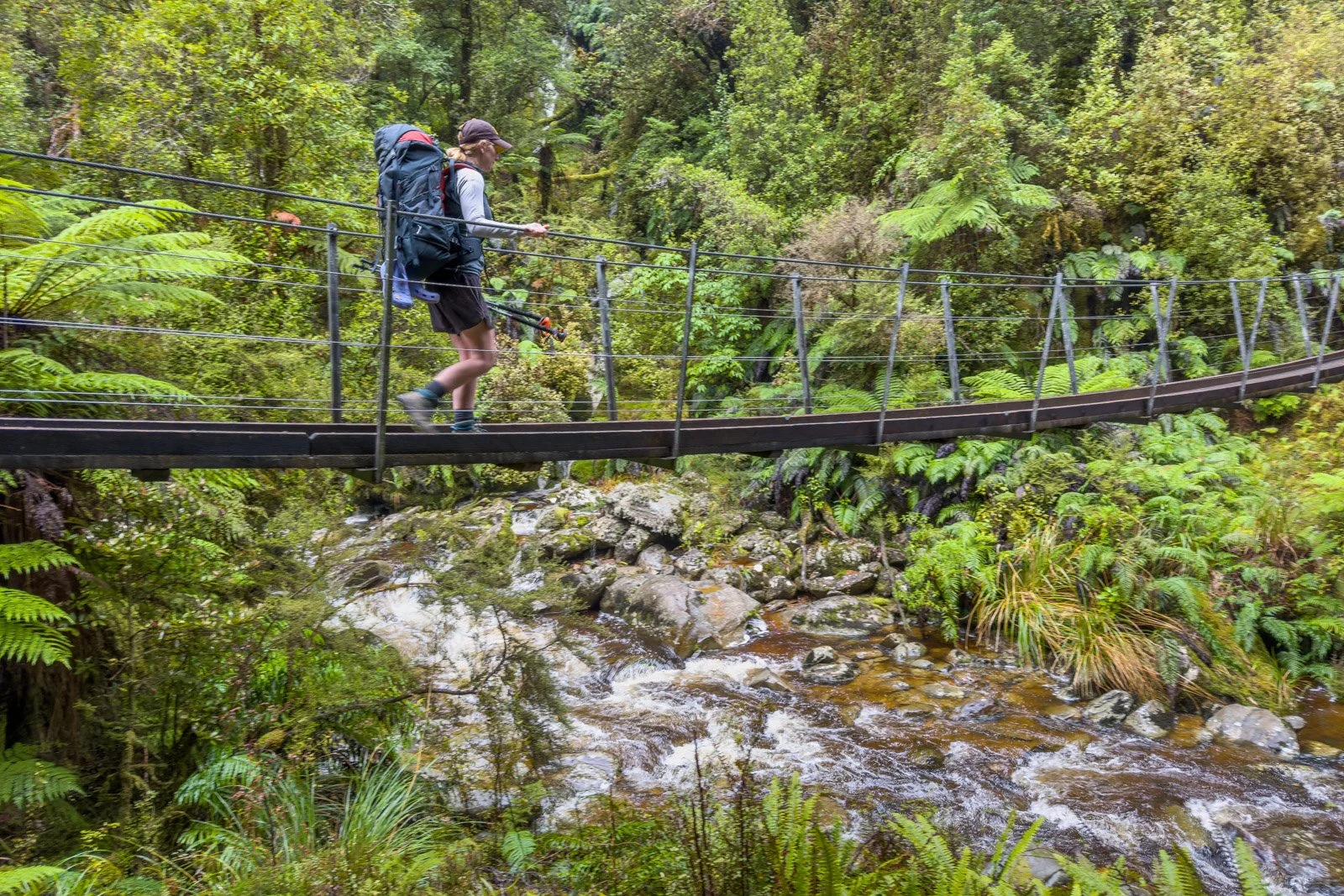
The first of several one-person swing bridges on Day 1
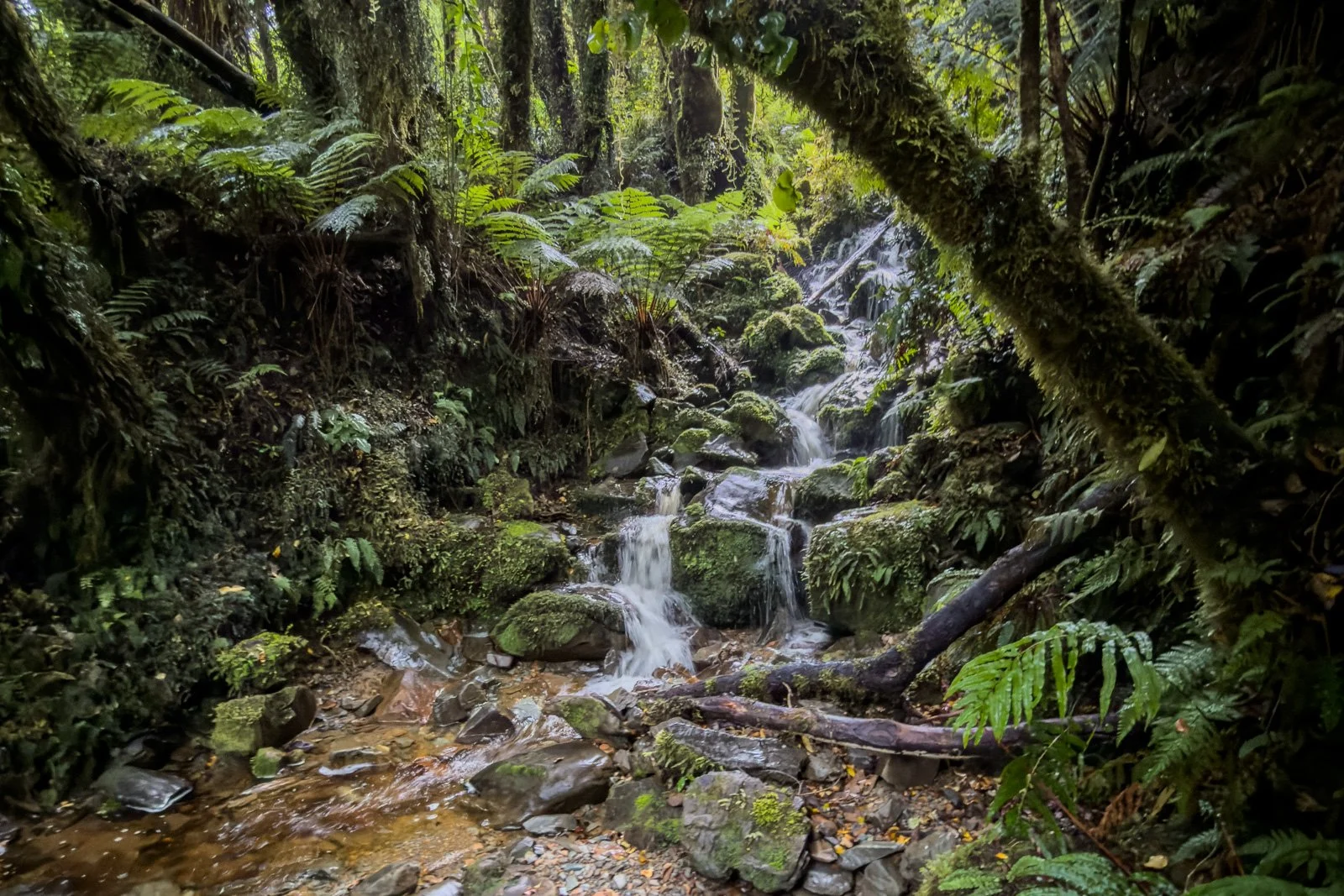
Track-side waterfall Paparoa Day 1
Just 10 minutes in, I also spotted my first ever blue entoloma, the vibrant blue fungus that is featured on New Zealand’s $50 note. I thought we might see them all the way along the track, but we only found them in that one spot, so I’m glad I was paying attention!
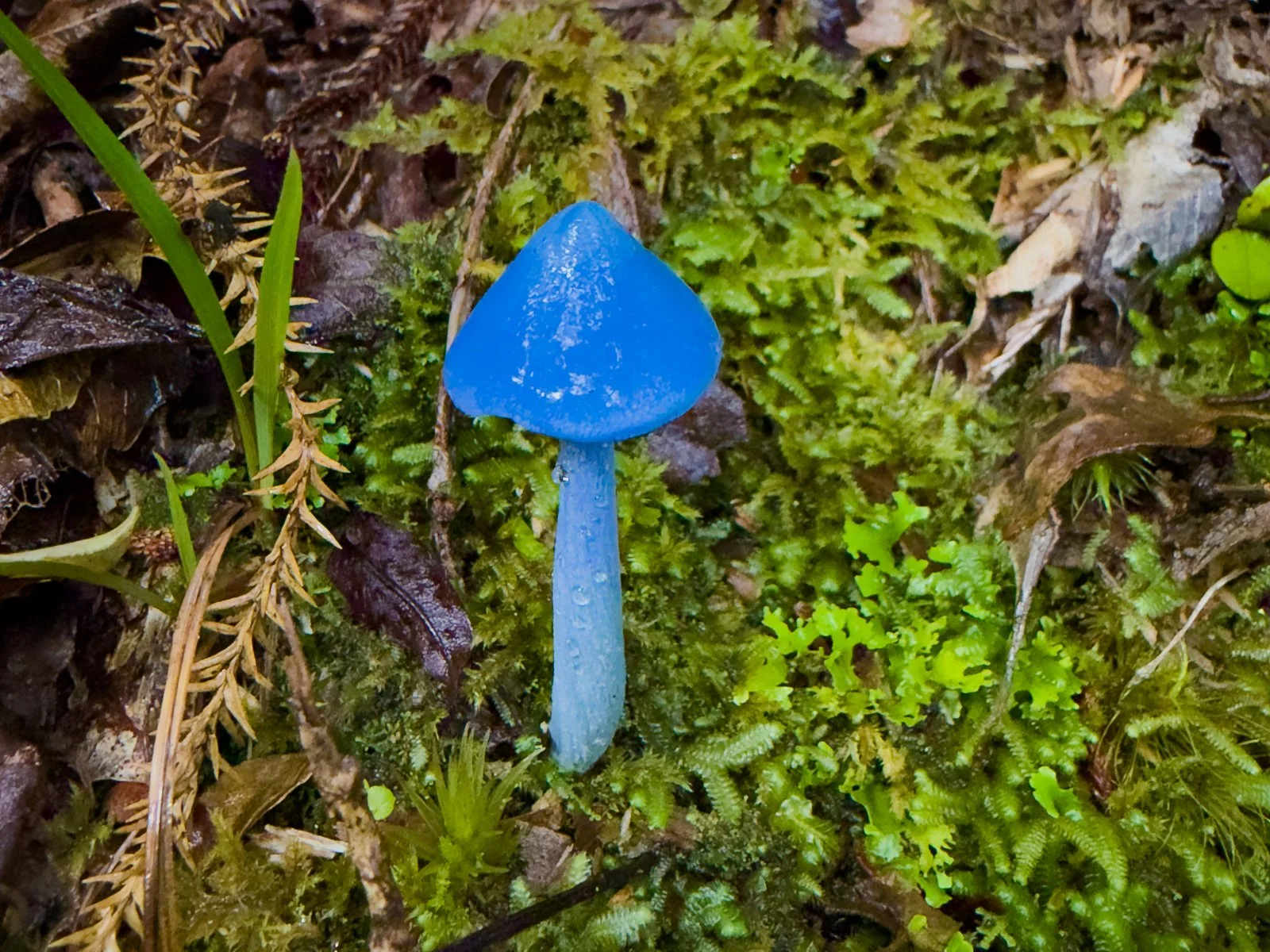
NZ’s famous blue entoloma (entoloma hochstetteri or werewere-kokako)
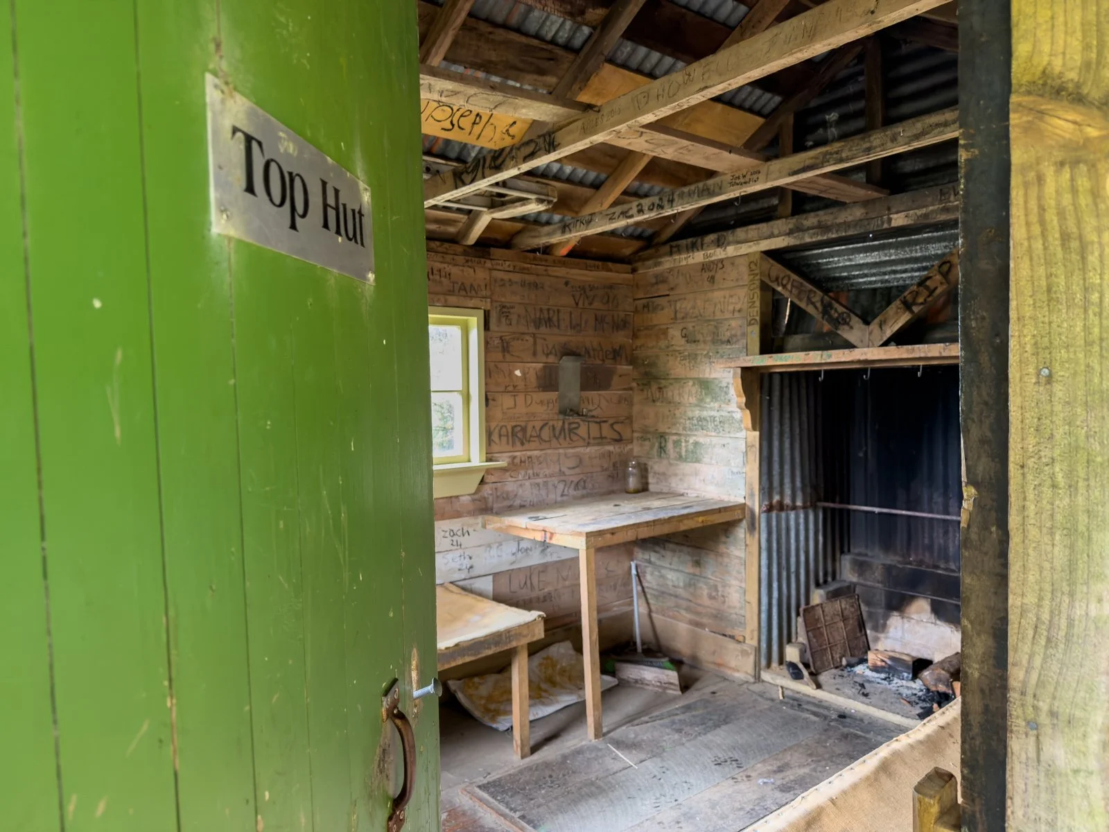
We also came across a family of weka on our climb to the hut (two adults and two chicks), which was a highlight, the first time I’ve seen a baby weka. Tucked in to the hillside just before you reach Ces Clark Hut is the historical Top Hut, and while I might complain below a little about how cosy Ces Clark Hut was, it was a still a lot more salubrious than the prospect of staying here in Top Hut!
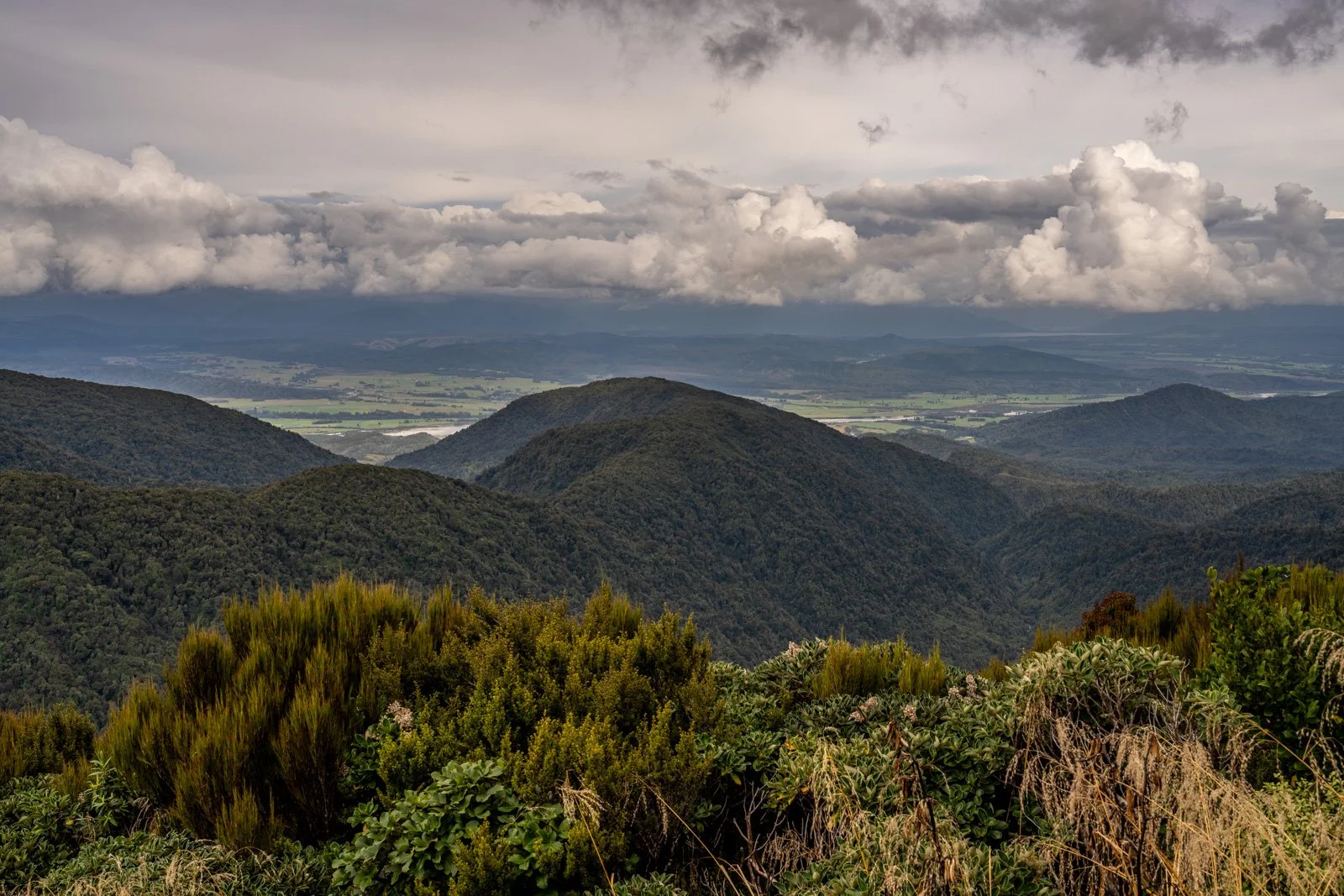
Ces Clark Hut (situated at 940m elevation) dates back to 1986, so while it’s not brand new like the other two huts, it’s been well incorporated into the Great Walk infrastructure. Apparently on a very clear day it is possible to see all the way to Aoraki Mt Cook, but on a more moody day, we had to make do with views across to the Grey River and further to Lake Brunner in the distance.
Views from Ces Clark Hut to Grey River with Lake Brunner in distance
Ces Clark Hut tucked on a ridge at 940m elevation
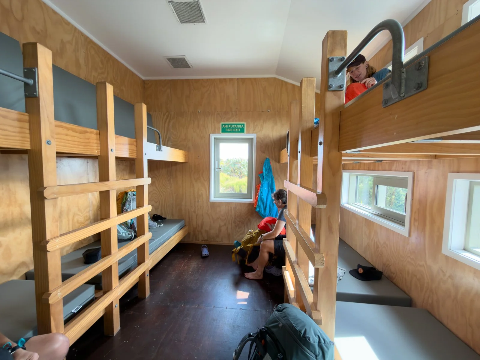
This is the one hut to skip if you are planning to complete the hike in three days. It’s rather compact and cosy, with 16 bunks in a single room, one small kitchen bench and a table that’s only big enough to seat about half the hut when full! We hiked the track over Easter weekend and the huts were completely full, so it was a very social experience, getting to know fellow hikers very quickly in close quarters, but it also made for a bit of a hot and restless night’s sleep!
Cosy interior of Ces Clark Hut
Day 1 Highlights: Blue entoloma, weka sightings, swing bridges, gentle climb
Things to note: Rocky sections underfoot, warm sleeping conditions in a full hut
Bonus: Surprisingly good cell reception
Day 2: Ces Clark Hut to Moonlight Tops Hut
Distance: 9.7km, 413m elevation
Time: 3 hours (actual time: 2:45)
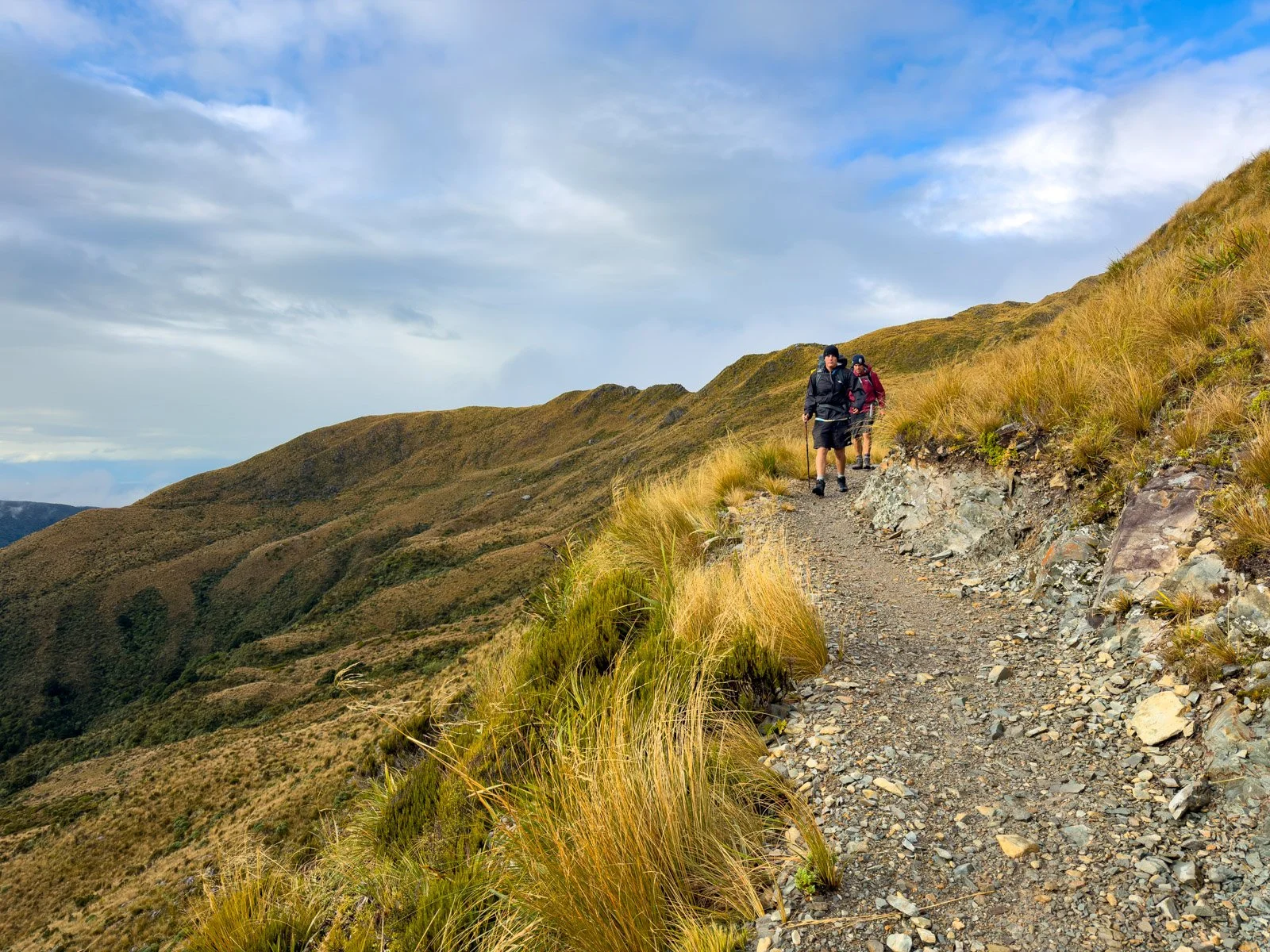
After overnight rain, we woke to moody, atmospheric conditions that slowly cleared as the morning progressed, perfect for giving us glimpses of distant views as well as easily seeing exactly where were were headed along the track.
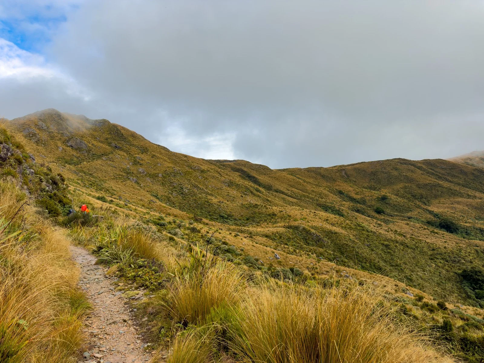
The track for Day 2 is visible well into in the distance along the ridges
Mist clears for views in all directions
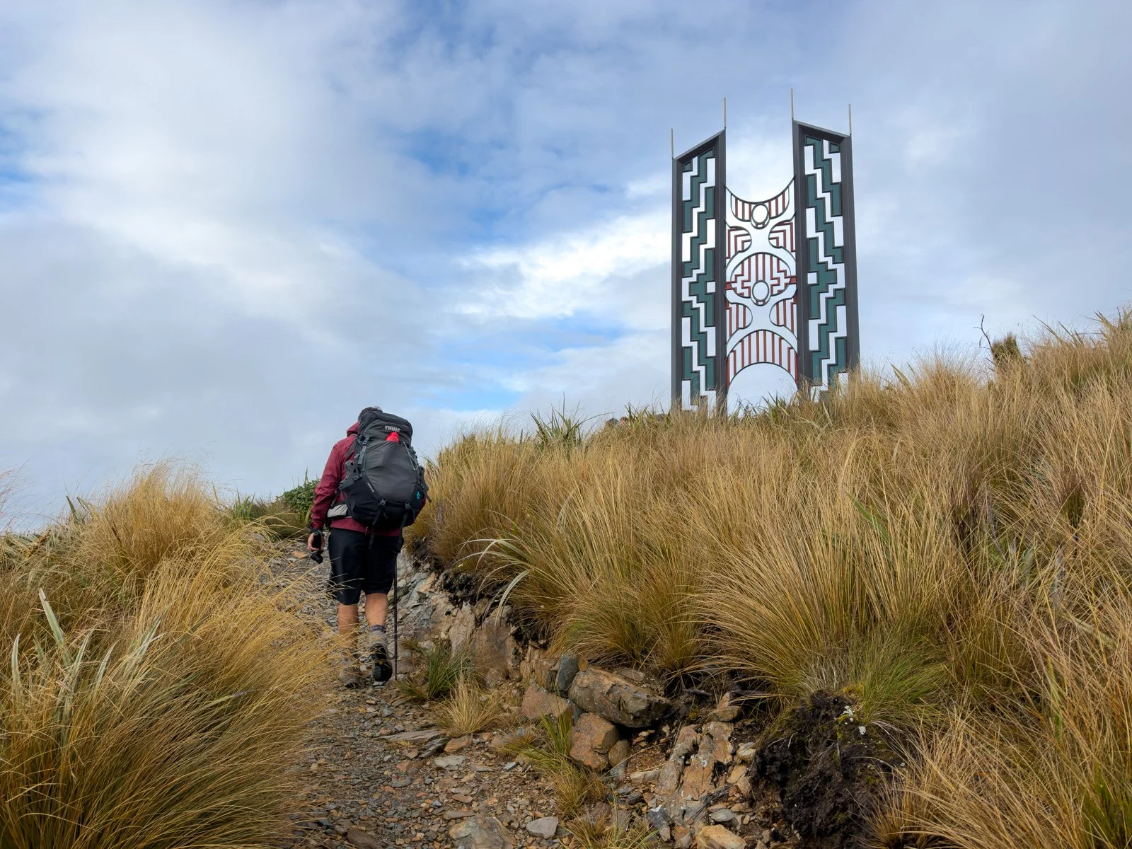
Sculpture on a high ridge Day 2
Looking back to where we came from at Ces Clark Hut (just over the hill far left corner)
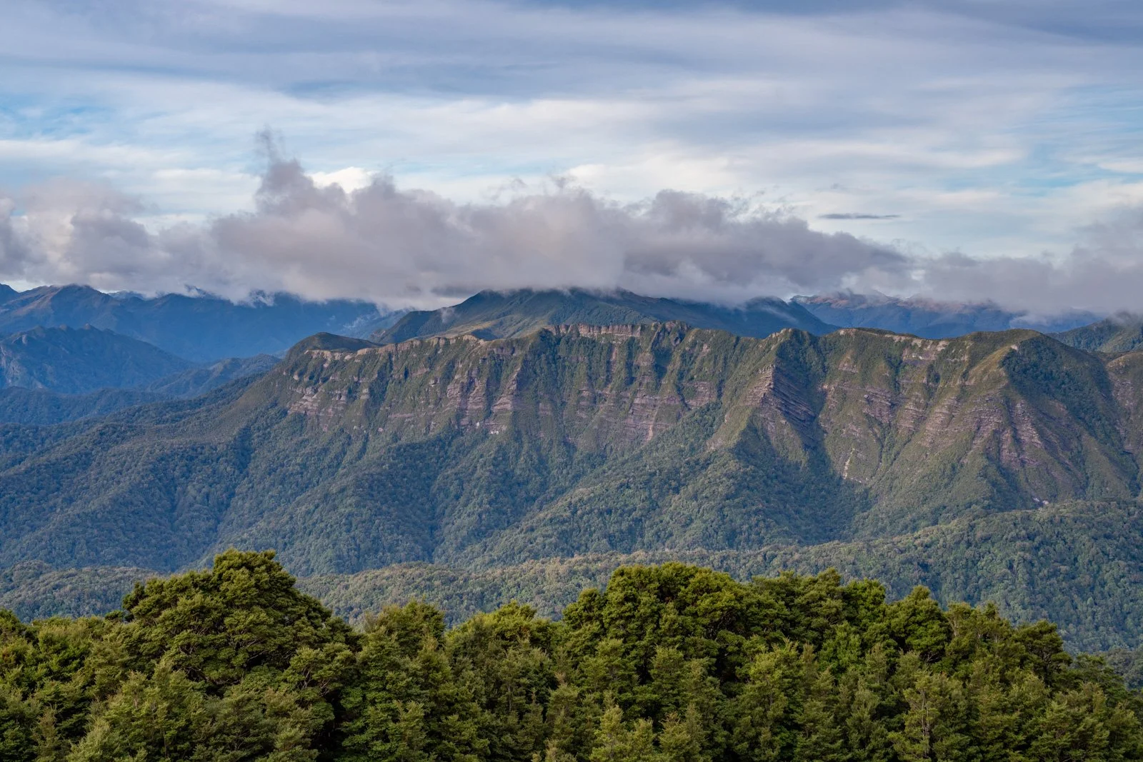
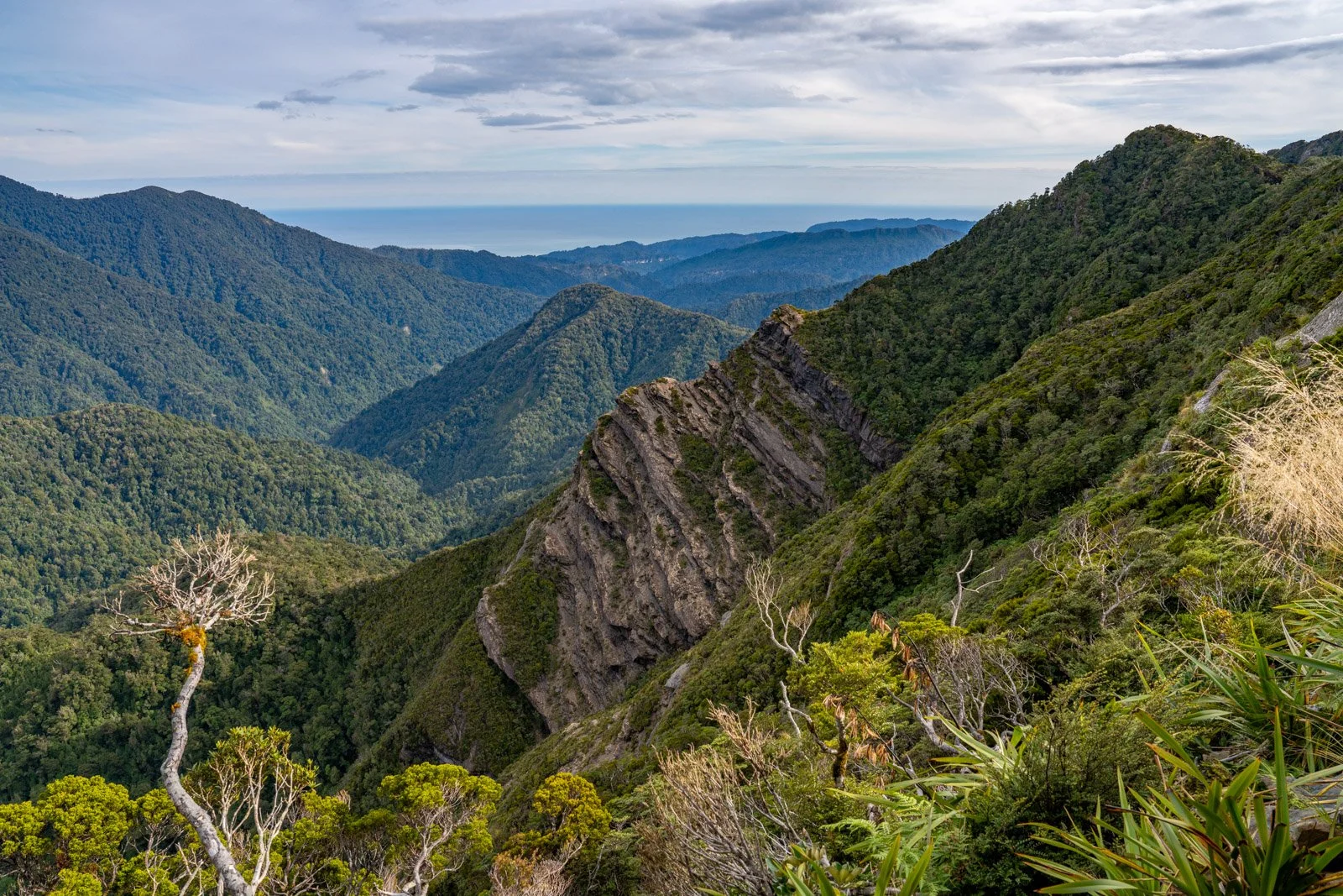
This day takes you along ridge tops staying at around 1,000 metres elevation the whole way, offering some of the most dramatic views of the entire track. BUT….it can be EXTREMELY exposed in places, and it’s not recommended to walk along here in strong winds. Make sure you check the forecast and follow the hut ranger’s advice for the day you are planning to walk this section.
First views of the West Coast (south to Point Elizabeth) from Paparoa Track ridge Day 2
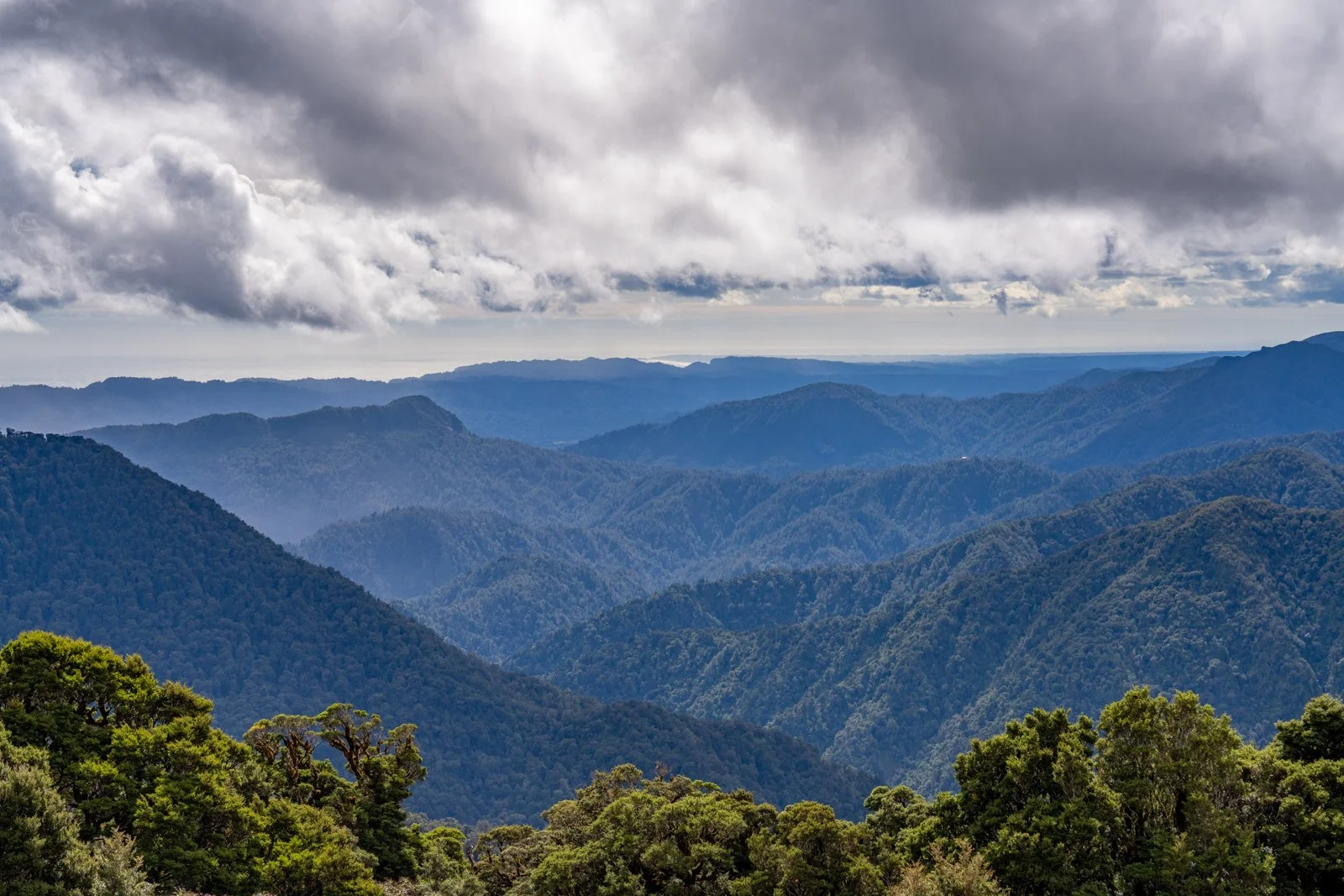
Not long into the hike, there are the odd glimpses of West Coast far below, and at one point along the tops you can see both the coastline near Barrytown to the west as well as distant inland mountain views to the east at the same time, it’s quite something!
Views both inland and to the coast at Barrytown Paparoa Track Day 2
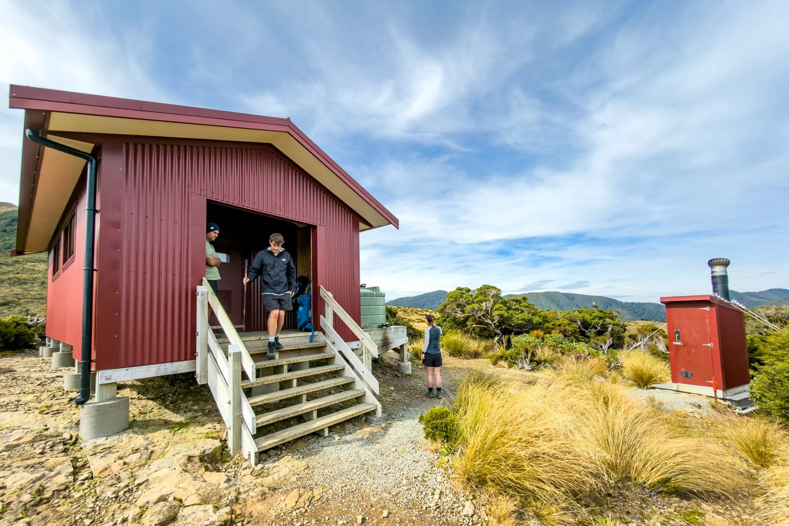
Moonlight Tops Hut is spectacularly positioned, with direct views across to the escarpment where coal seams are clearly visible. You can even spot Pororari Hut 8km away as the crow flies in the distance, though actually reaching it takes a full 19.1km day’s hike.
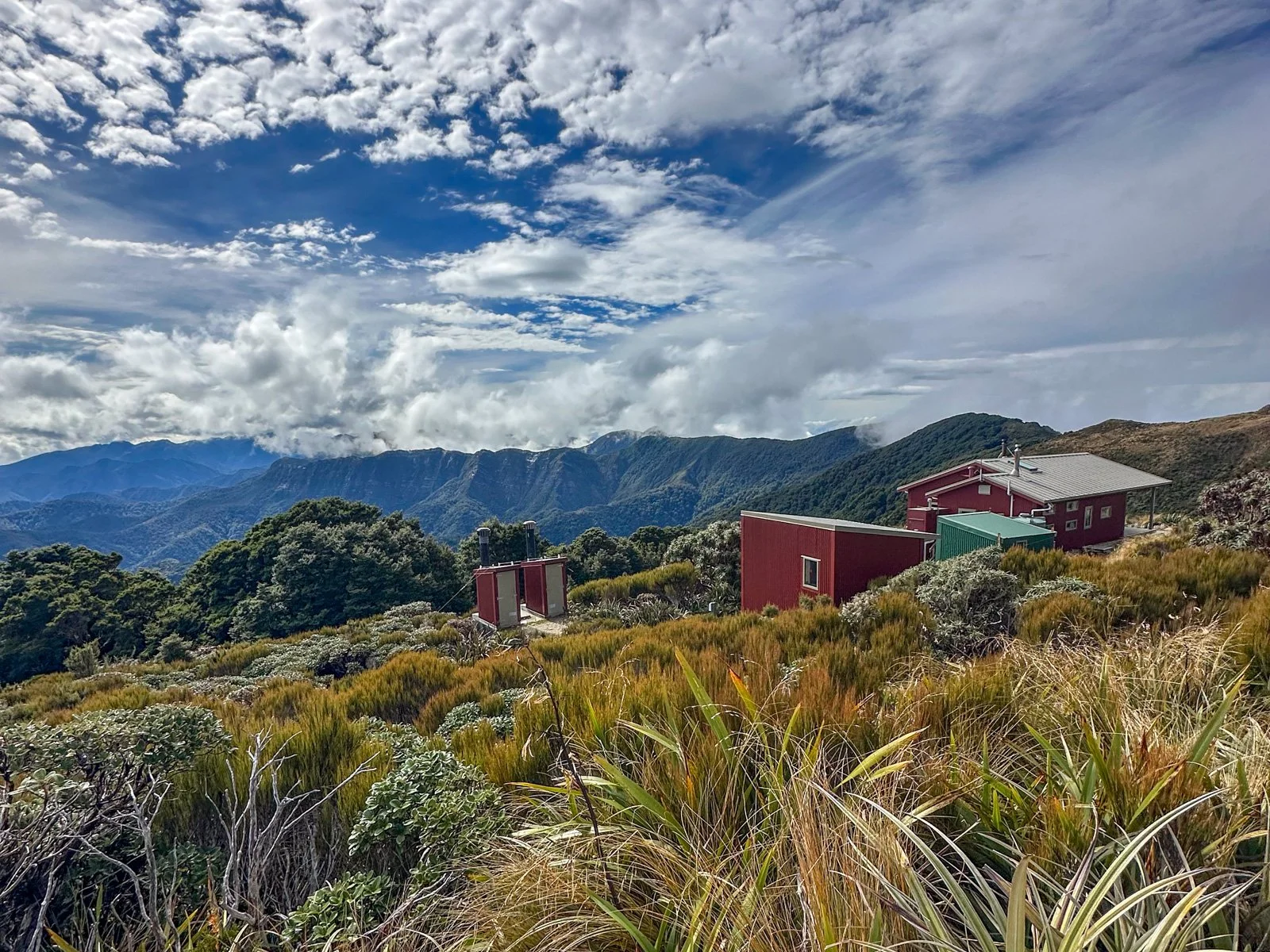
The spectacular position of Moonlight Tops Hut at 1020m elevation
Can you spot Pororari Hut? Look for the roof reflecting on the ridgeline in the middle right of the photo. The coast is visible in the distance too.
The hut itself is modern and well-designed, with two bunk rooms off the main area (a smaller room having 8 bunks in a standard one up, one down configuration) and a bigger 12-person bunkroom with an upper/lower platform sleeping six on each). The dining room and kitchen is spacious with 3 large tables and plenty of large metal kettles for quick boiling, something you quickly come to appreciate!
The smaller of the two bunk rooms in Moonlight Tops Hut
Moonlight Tops Hut - great views out the window
Last light on the Paparoa escarpment from Moonlight Tops Hut
In the late afternoon light the escarpment looks particularly impressive, and it made us really look forward to walking across those tops tomorrow!
Day 2 Highlights: Ridge-top walking, escarpment scenery, dramatic views inland and to the coast
Things to note: Very exposed sections if windy, limited cell reception at the hut
Bonus: Seeing the next hut in the distance
Day 3: Moonlight Tops Hut to Pororari Hut
Distance: 19.1km, 531m elevation
Time: 5-7 hours (actual time 5:25)
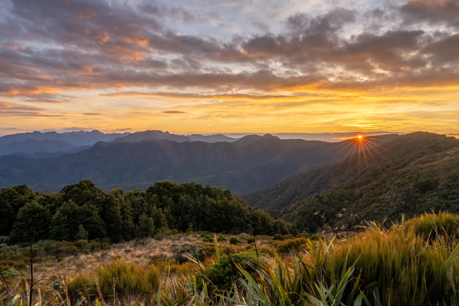
We started the day with an incredible sunrise, lighting up the layered hills to the north, as a photographer this was a definite highlight of the hike!
Sunrise from Moonlight Tops Hut
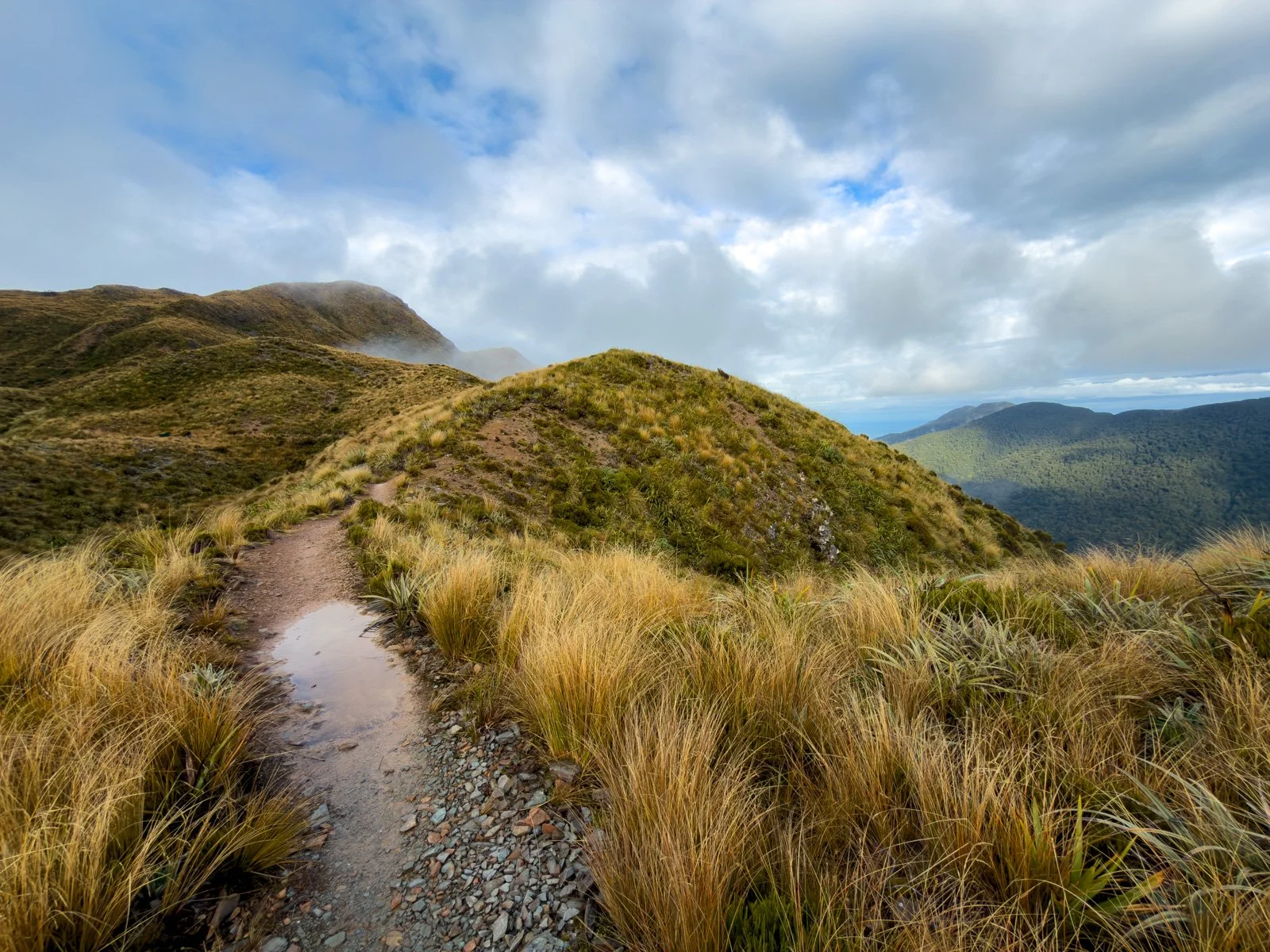
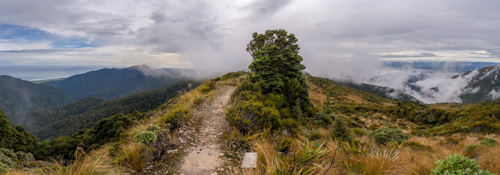
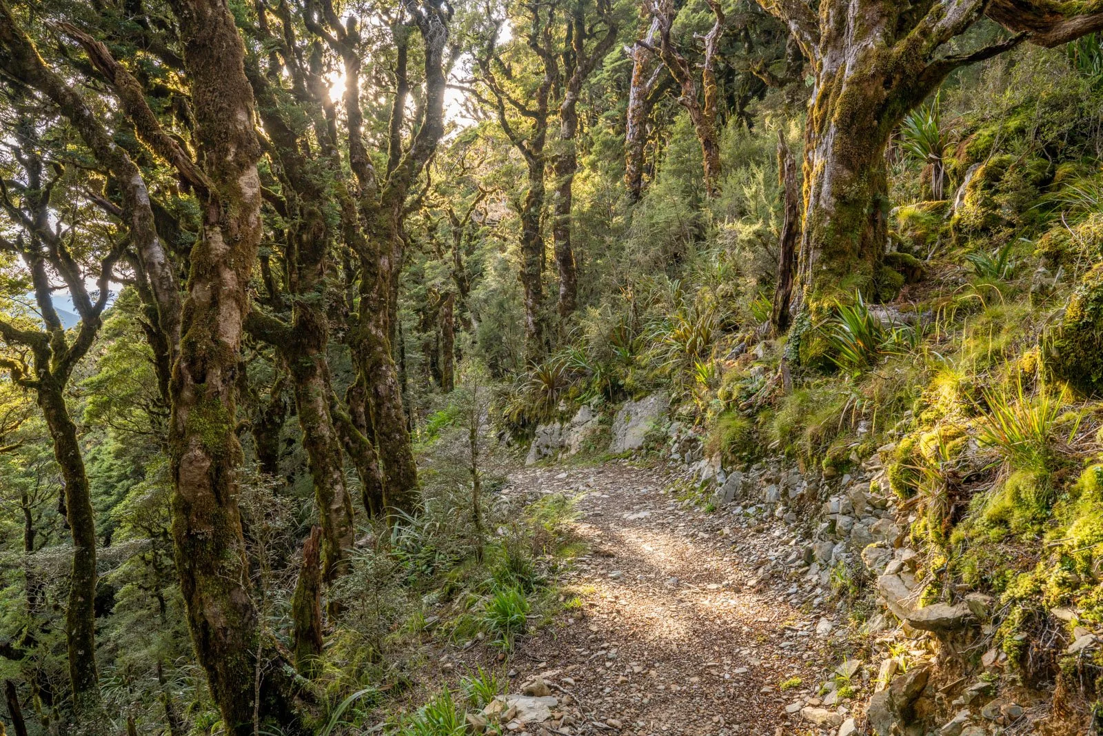
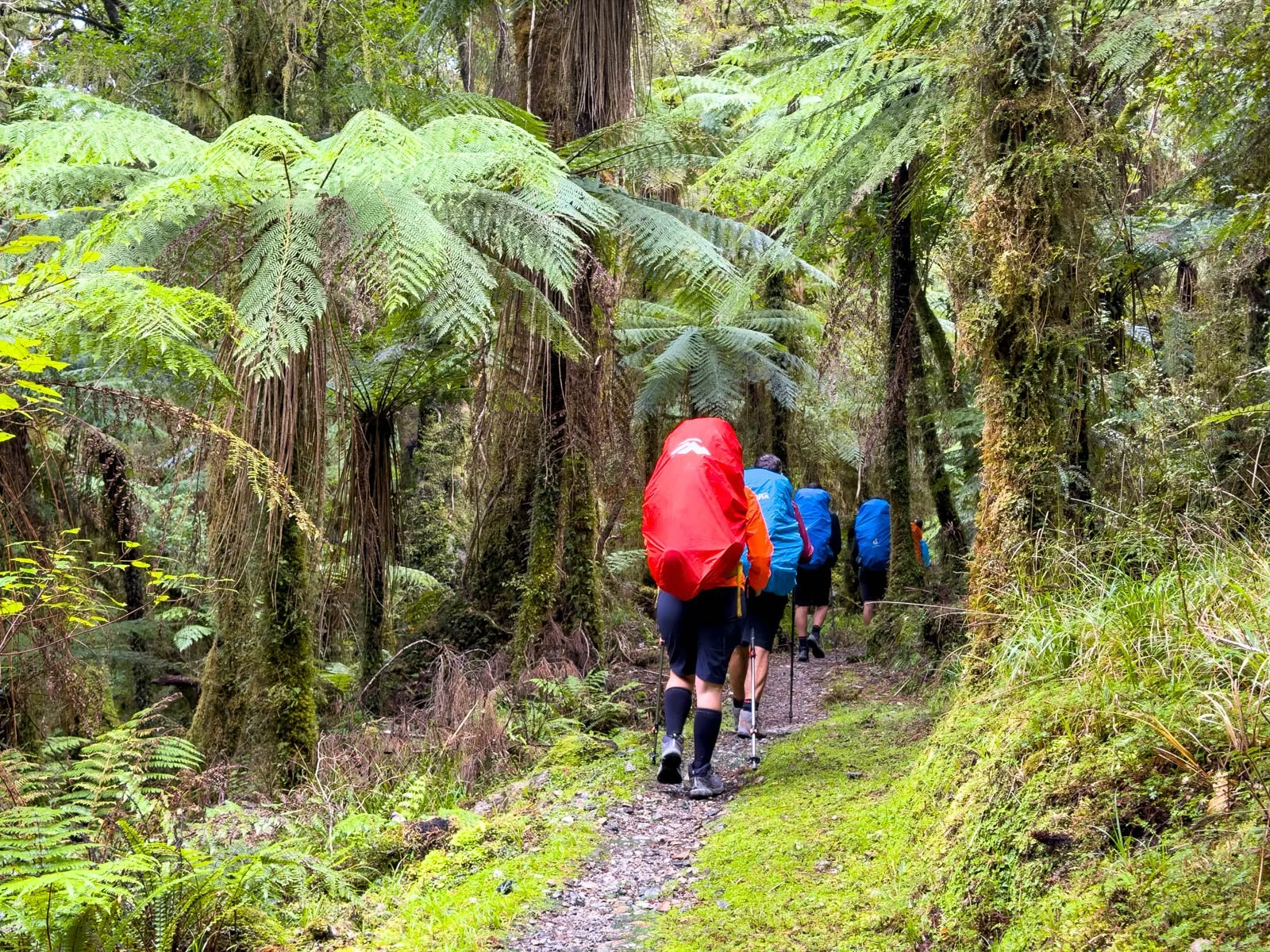
Despite the high elevation, we quickly dipped into an enchanting section of goblin forest just 15 minutes from the hut, a surprising and beautiful contrast to the tussocky tops we’d just left, especially with the early morning light streaming in.
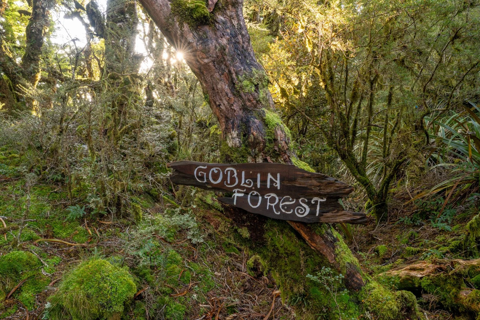
Goblin forest Day 3 Paparoa Track
Early morning light in goblin forest, Paparoa Track
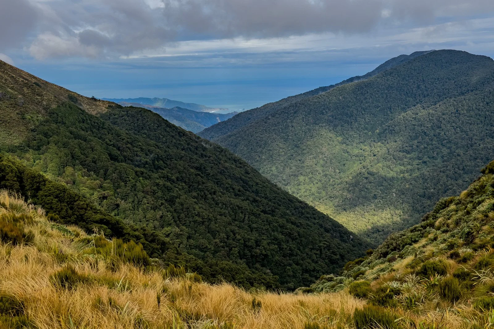
From there, the track eventually comes back out of the forest near the turnoff to the Pike 29 Memorial Track (a steep 11km track that leads back down to another valley floor), before continuing right along the escarpment with sweeping views. It’s quite encouraging to look back from time to time and see Moonlight Tops Hut in the distance, surprising you with just how quickly you’ve made it to this point!
Up close to the escarpment with coastal views, Paparoa Track
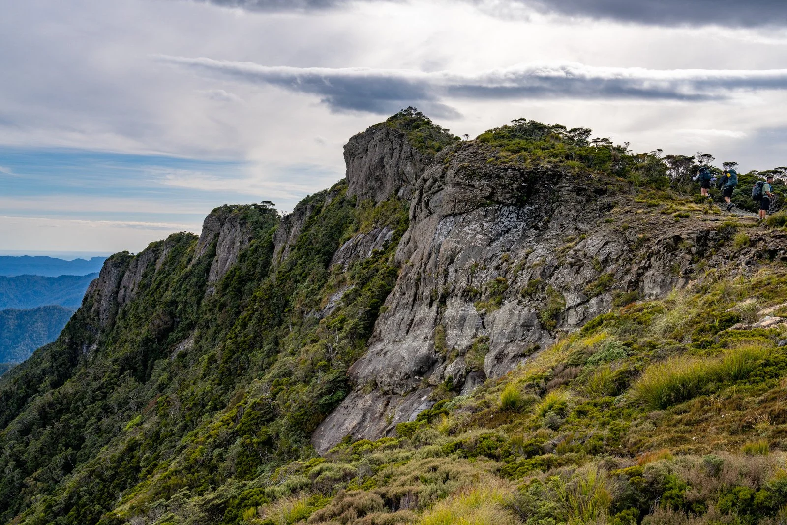
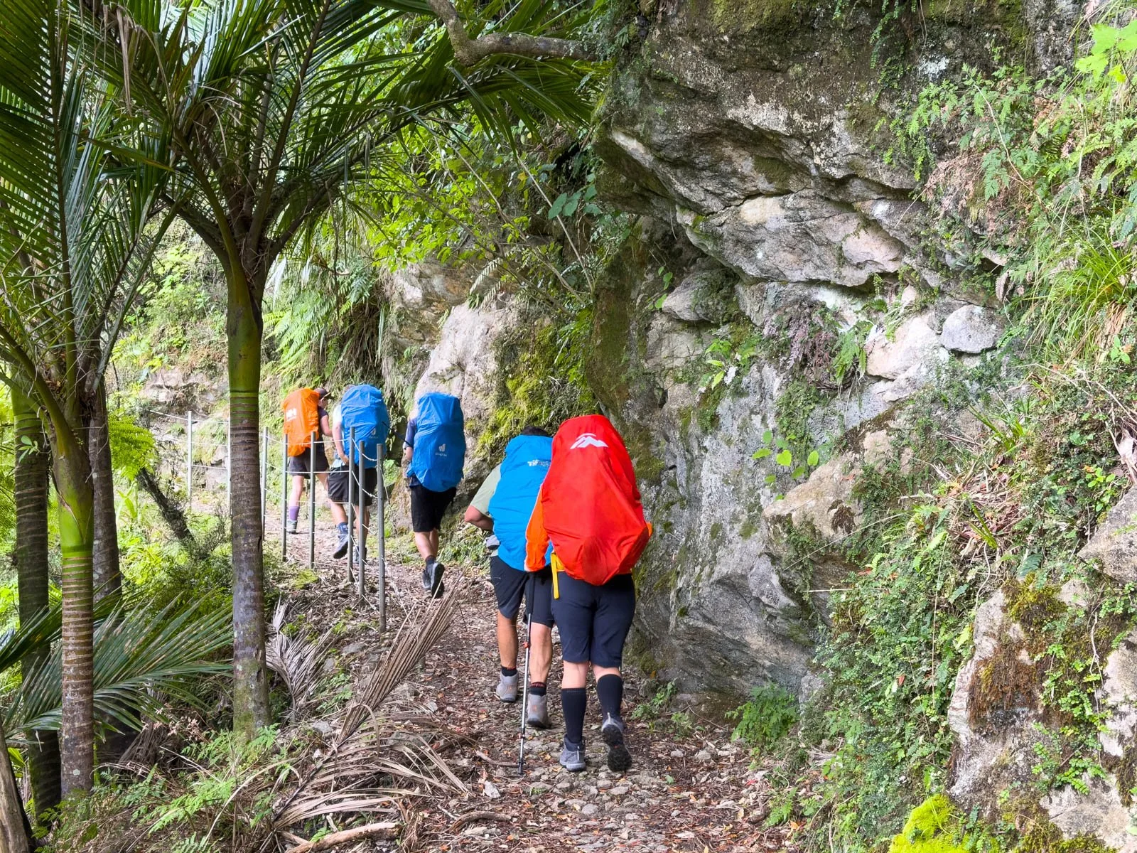
Note the hikers in our group top right as we head up and across the cliff tops
The halfway point brings you to an emergency shelter, which makes a great place for a quick sit down inside, snacks and a toilet stop. I’m sure on some days it’s also a welcome relief for hikers to get out of cold, windy and miserable weather, but we were lucky to have a great day to hike this section of the track.
Emergency shelter, halfway point Day 3 Paparoa
Not long after leaving the shelter, you encounter the steepest descent of the entire track, with fenced off switchbacks (mostly there for biker safety) leading back down into the forest and past a waterfall seen from a large suspension bridge.
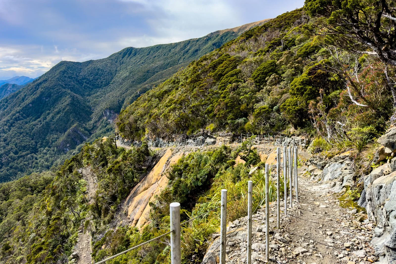
Steep switchbacks on Paparoa Day 3 (note the track coming back on itself bottom left)
Waterfall Day 3 Paparoa Track
The final section winds somewhat up and down through varied terrain including a tree/rock tunnel, before the final steady climb up to Pororari Hut.
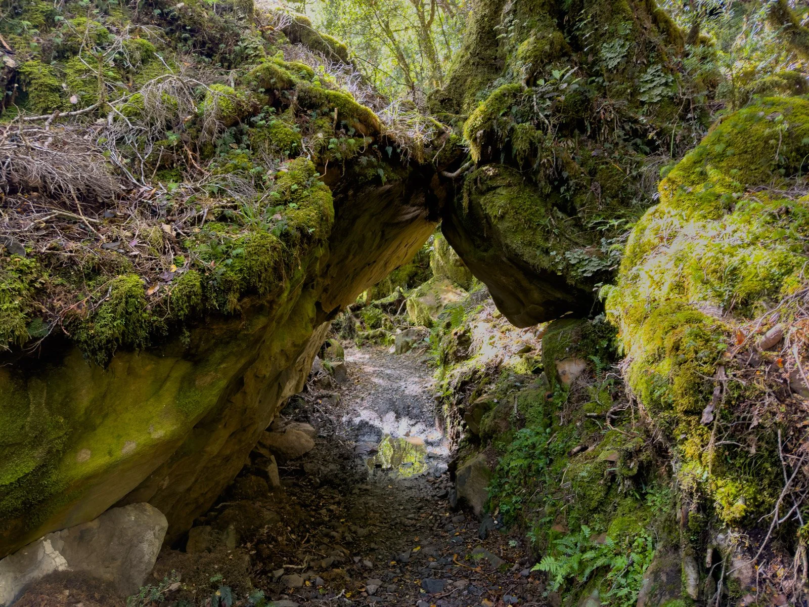
Passing through a rock / tree tunnel Day 3
This was probably the most rewarding (if exhausting!) day of the hike, combining dramatic cliff-top landscapes and views with constantly changing environments.
Pororari Hut is situated at 545m, so although you have descended 500m from Moonlight Tops, the hike also records a climb of 500m in elevation, so overall you’ll have descended 1000m that day as well as covering 19km, so it does feel like a decent effort, and we all felt ready to reach the hut from about 15km onwards! The hut sits in a nice open clearing, thanks to Cyclones Fehi and Gita (2018), which cleared large sections of forest in the vicinity. While this delayed the track construction at the time, it has had the unexpected benefit of offering hikers more expansive views. The hut setup is identical to Moonlight Tops Hut with the large dining/kitchen and 2 bunk rooms.
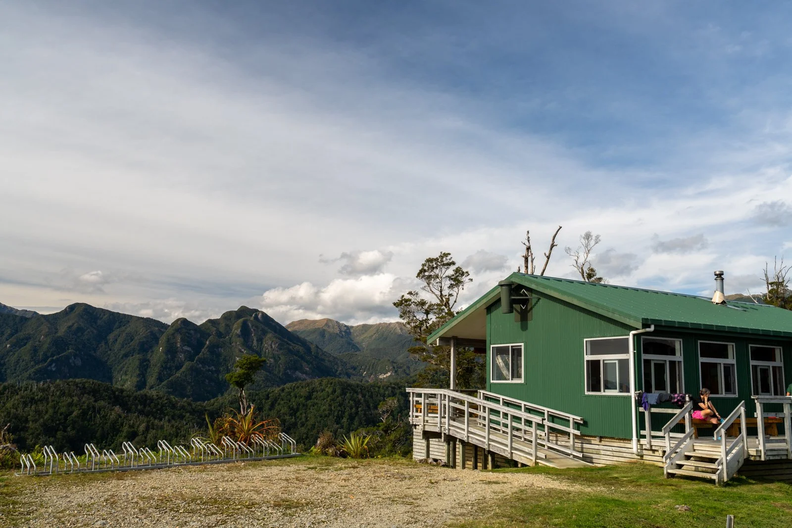
Pororari Hut is situated in a nice, open clearing with 360 degree views, despite being at a lower elevation than the other two huts.
Views to the sea where we will head tomorrow - only 16km away!
Look closely, you’ll see the switchbacks on the ridge above the bare tree branch, the emergency shelter is just visible as a tiny speck above this.
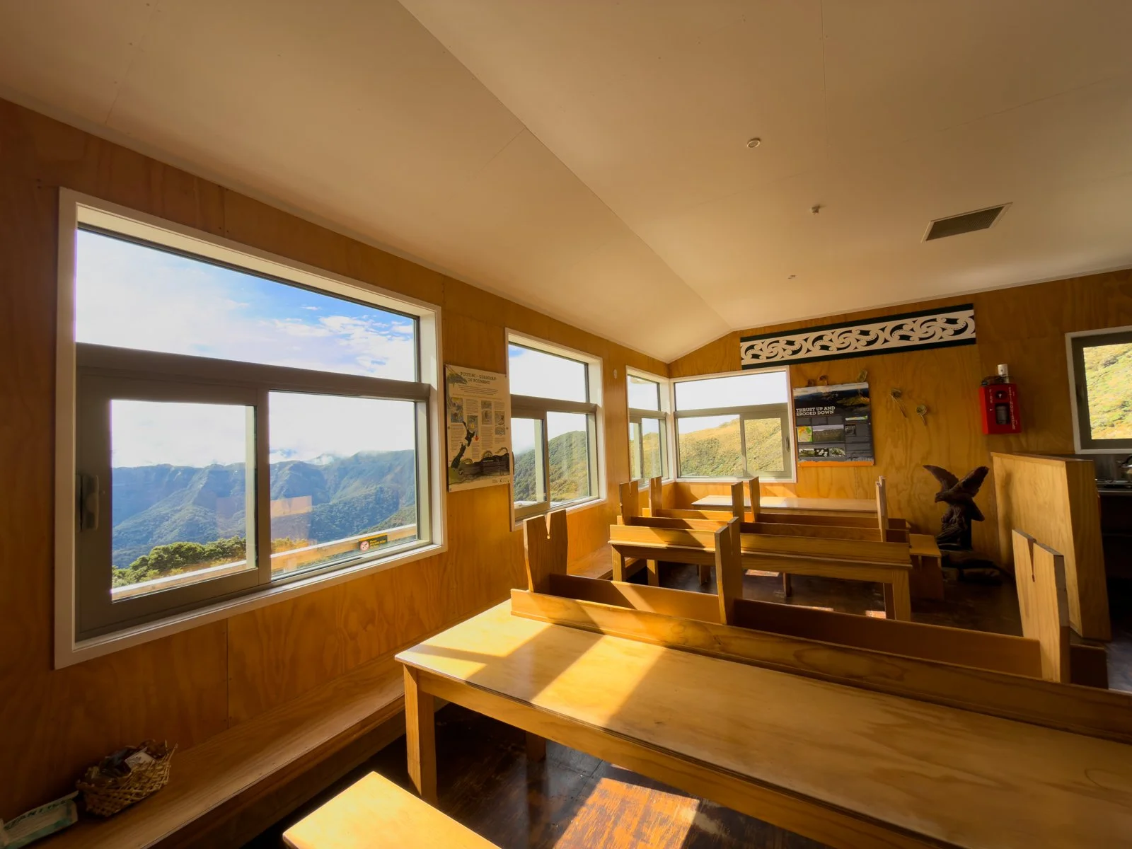
Pororari Hut was also the only hut with a DOC ranger present, which added a nice touch, hearing stories and insights about the track build and surrounding area always makes for a richer experience, and it helps when the ranger is a genuine good guy like Joe Fitzgerald - we all enjoyed meeting him!
Here you can also read how the track was built over 28 months - it’s a fascinating story spread across various information boards in the hut, where “every tree is a conversation” made for a unique approach to the build, including keeping the track to a maximum width of 1.2 metres, ensuring wildlife habitats weren’t negatively impacted, and using material removed to rehabilitate the areas along the track edges.
It was another hot night for sleeping, but I did hear a kiwi in the middle of the night, apparently they are prolific in the area!
Day 3 Highlights: Sunrise, extensive escarpment views, goblin forest, waterfall, our hut ranger
Things to note: Longest day, one short, steep descent section. No cellphone reception.
Interesting insight: The care to preserve the natural environment while building the track, and the dedication of the work teams who built it.
Day 4: Pororari Hut to Punakaiki
Distance: 16.1km, 205m elevation
Time: 4–5 hours (actual time 4:15)
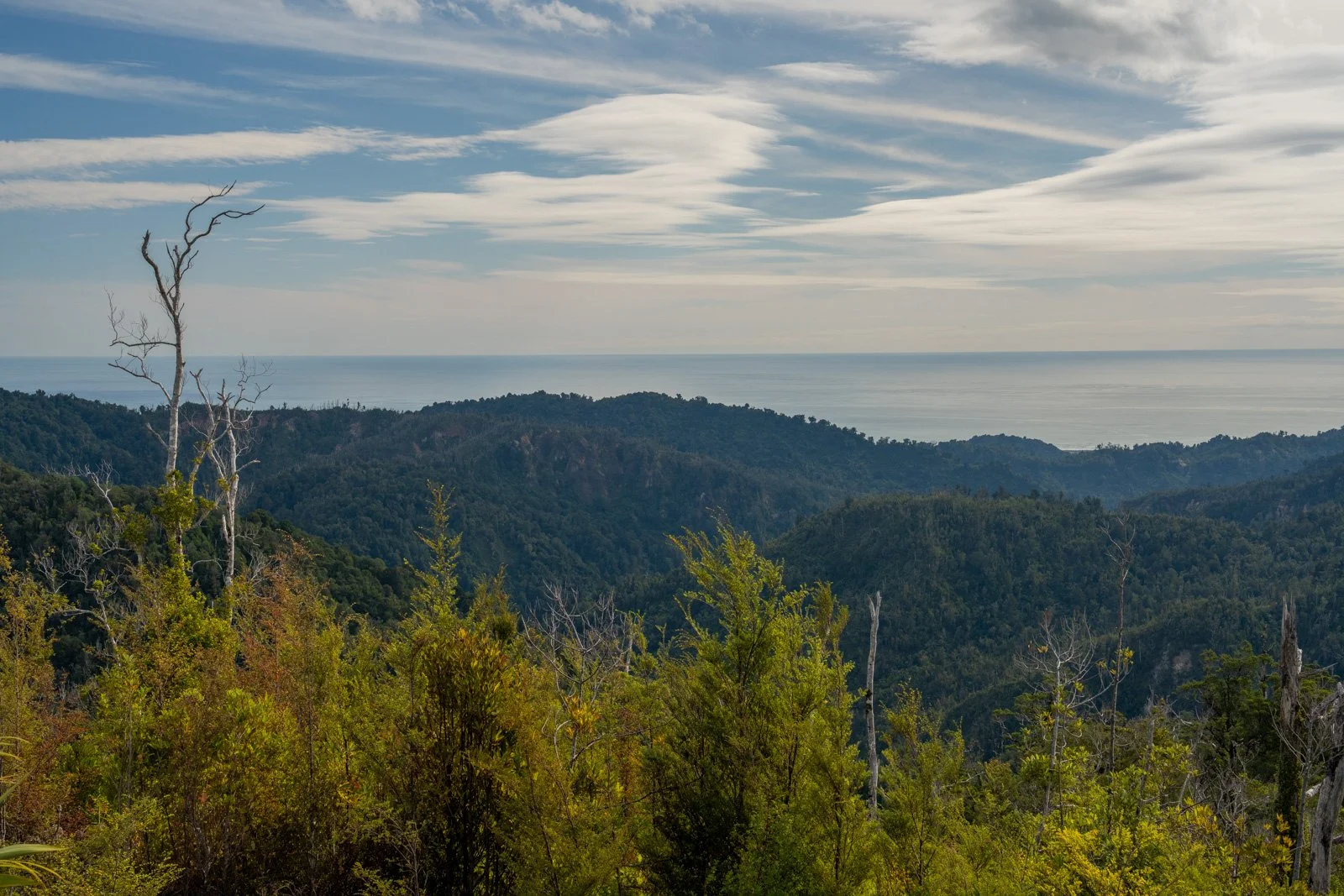
The final day is all about the forest, and it’s fascinating to watch it transform as you descend towards the coast.
Within minutes of leaving the hut, we encountered a wild goat on the track which was curious, but also smart enough at keeping its distance.
Starting in temperate rainforest on Day 4
A flatter track for Day 4 through the forest
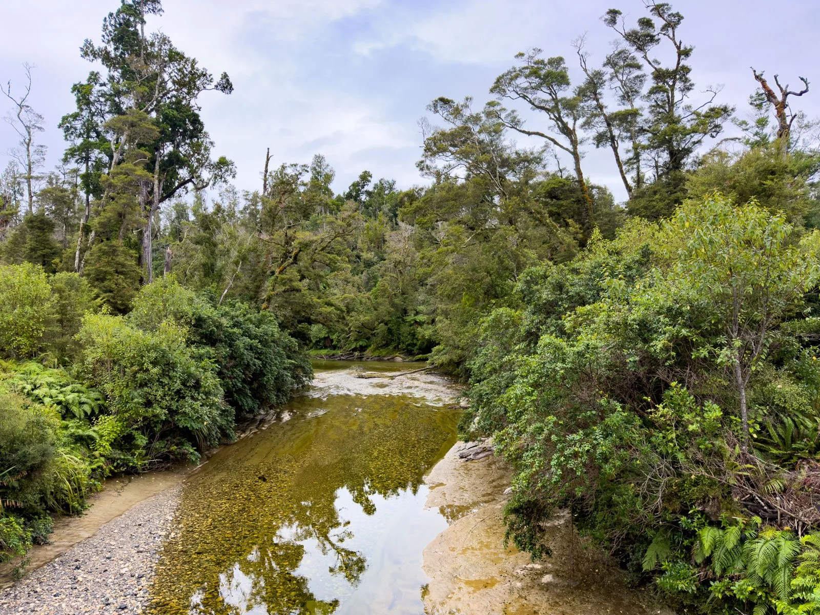
The trail feels relatively easy and flowing, taking you through beautiful temperate rainforest, across multiple bridges, and alongside the Pororari River. We also spotted whio down in the river from one of the many suspension bridges, it was my first time actually seeing them on a Great Walk!
Crossing one of many suspension bridges over rivers Day 4
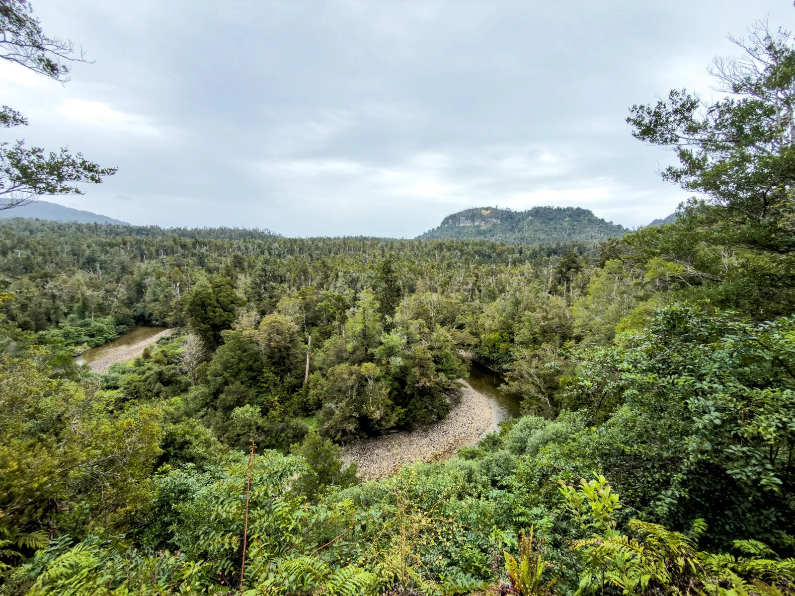
A horseshoe bend in the river and forest views, Day 4 Paparoa
As you near the coast, nikau palms begin to appear, adding a distinctly subtropical feel to the landscape.
Nikau palms start to appear the closer you get to the coast
We encountered a bit of drizzle on this day, but it was the only time we needed our rain jackets on the whole 4 day hike, which was far better than the forecast had initially suggested before we set out. A good reminder that the West Coast (and NZ weather in general!) doesn’t always behave as expected!
Near the end, the track splits as cyclists head out to Waikori Road, while hikers continue alongside the Pororari River for another 3.5 km before finishing at Punakaiki.
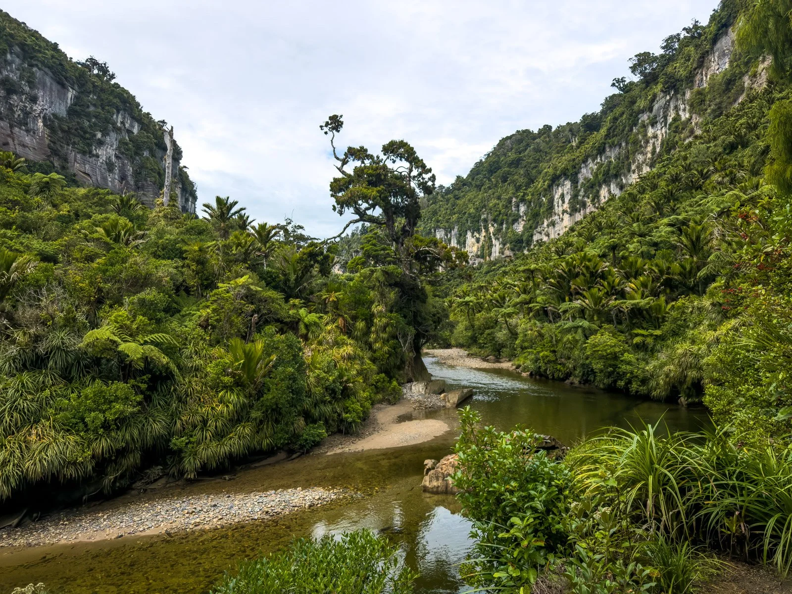
The winding Pororari River not far from the end at Punakaiki with impressive limestone cliffs on either side.
Day 4 Highlights: Changing forest ecosystems, river walk, nikau palms
Things to note: Mostly easy downhill and flat walking, a few small undulations near the end
Overall feel: A relaxed and scenic finish to an incredibly varied track
Difficulty Rating
I would rate this is a relatively, easy Great Walk hike especially when spread across the full 4 days rather than rushing to do it in just three. The longer days come at the end when your packs are lighter and the track is mostly downhill. Plus the easy, gradient of the dual-use track makes it a pleasure to walk on with hardly any stairs (only a few in the last couple of km after the track splits into biking/hiking separately), and there no tree roots to clamber over either!
Final Thoughts
The Paparoa Track is a standout Great Walk for its diversity, combining dramatic ridge-top views, rich mining history, lush rainforest, and beautifully positioned huts. So, if you’re looking for a multi-day hike that offers both visual variety and a slightly more gradual walking experience (without sacrificing scenery), this track absolutely delivers.
Finally, enjoy this short 5 minute highlight video so you know what you can expect from this epic location!